2/1/2014
2/1/2014
2/1/2014
Landmark information
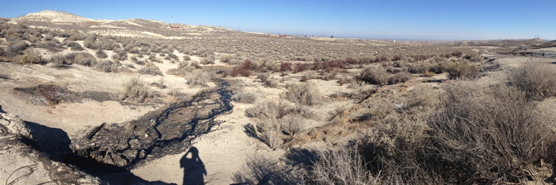
- Location:
SW corner of intersection of State Hwy 33 (PM 33.5) and State Hwy 58 (PM 15.4), 0.5 mi S of McKittrick - Plaque:
Other Plaque - Site:
Existing - Date First Visited:
12/6/1996 - Date Most Recently Visited:
2/1/2014 - GPS Coordinates:
N 35 17.763, W 119 37.434
About this landmark
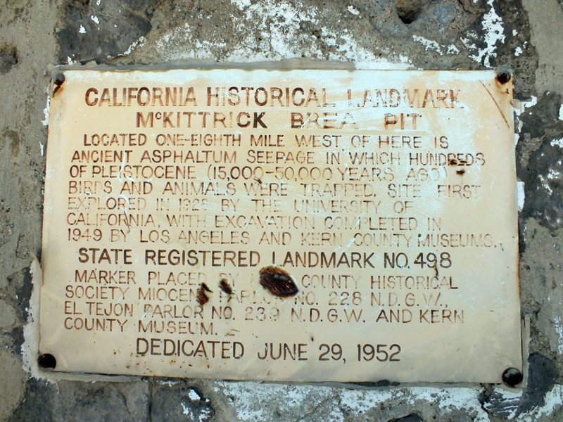
Plaque text:
California Historical Landmark
McKittrick Brea Pit
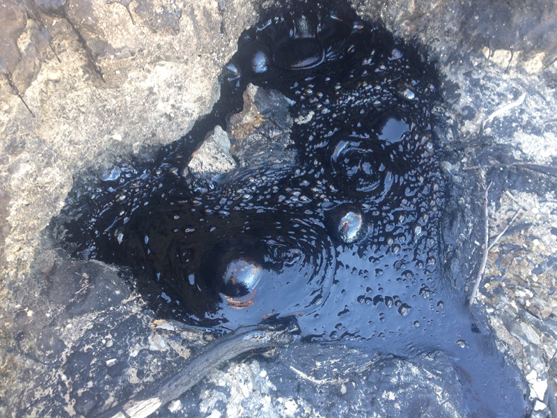
Locate one-eighth mile west of here is ancient asphaltum seepage in which hundreds of Pleistocene (15,000-50,000 years ago) birds and animals were trapped. Site first explored in 1928 by the University of California, with excavation completed in 1949 by Los Angeles and Kern County museums.