6/19/1998
Landmark information
- Location:
4189 Hwy 140 (PM 17.2), 3.2 mi W of Mariposa - Plaque:
Other Plaque - Site:
Nothing Remains - Date First Visited:
6/19/1998 - Date Most Recently Visited:
6/19/1998 - GPS Coordinates:
N 37 28.868, W 120 0.642
About this landmark
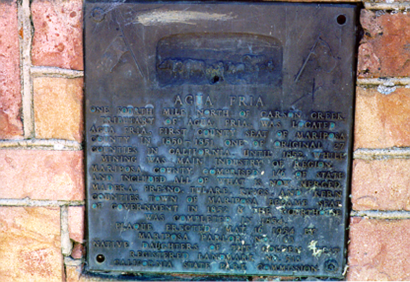
Plaque text:
Agua Fria
One fourth mile north of Carson Creek, tributary of Agua Fria, was located Agua Fria, first county seat of Mariposa County in 1850-51, one of original 27 counties in California. Until 1852, while mining was main industry of region, Mariposa County comprised 1/6 of state and included all of what is now Merced, Madera, Fresno, Tulare, Kings, and Kern counties. Town of Mariposa became seat of government in 1852 & the courthouse was completed in 1854.