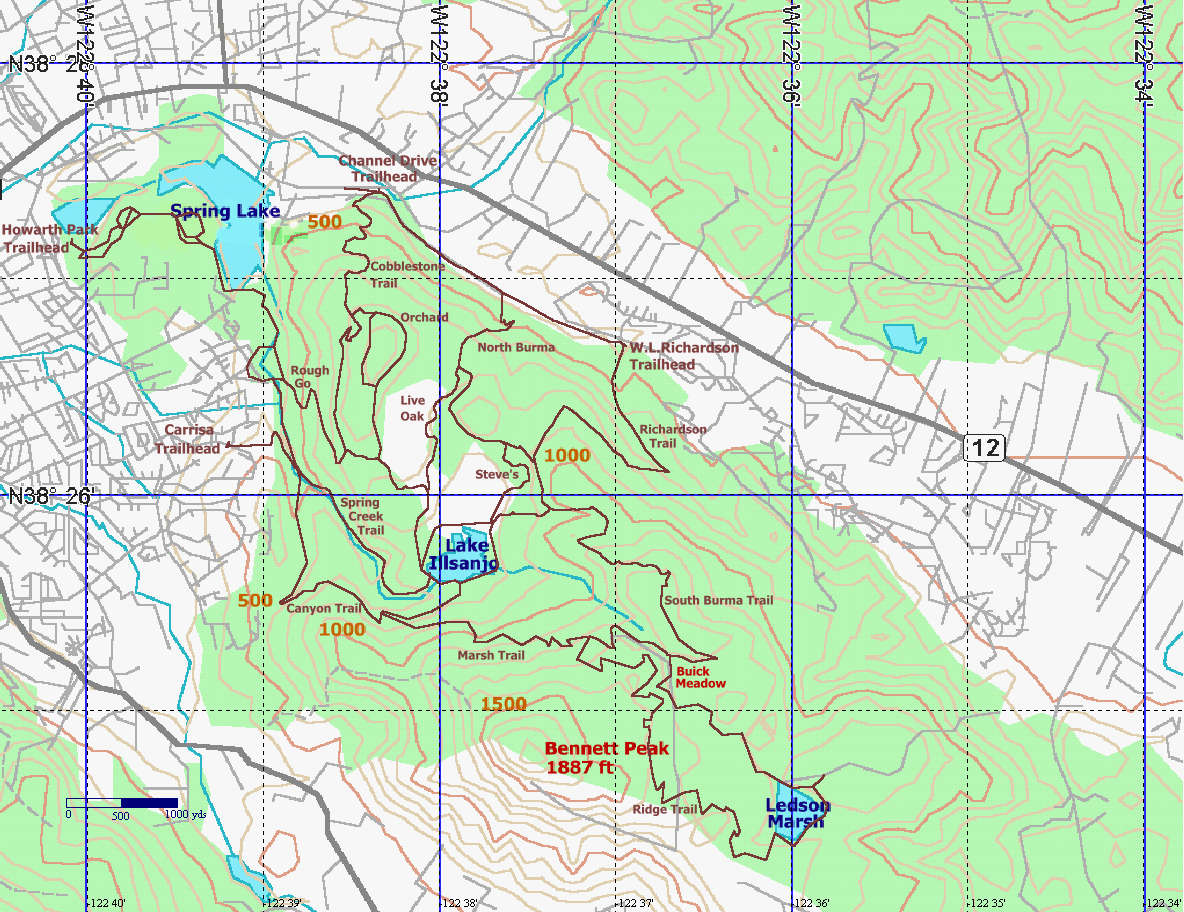
Note: A Garmin GPS12MAP receiver was used to capture trail location information. The track logs were then placed on a Topo image of Annadel to create the map shown above.
Updated: July 20,2001