Emergency no more?
What's the story with those
"Emergency" wells in the Laguna de Santa Rosa? An O.W.L.
Foundation White Paper explores the history and use
of these "stand-by" wells and how they have been forced
into full time production wells.
SCWA “Emergency Wells” and the WSA
History
Between 1975-1977, northern California experienced one of
the most severe droughts of the century - remembered as the “76-77
drought.” In 1977, the Sonoma County Water Agency
(SCWA) predicted the Russian River would go dry in “
the
later part of October or November” (SCWA, 1977a).
SCWA drilled the “emergency wells” after decision “
to
proceed on an emergency basis and bypass provisions of the
California Environmental Quality Act” (SCWA, 1977a). The
Occidental Road, Sebastopol Road, and Todd Road emergency
wells were drilled in the western Santa Rosa Plain near the
Laguna de Santa Rosa east of Sebastopol (see Figure 1). Additionally,
three deep wells were drilled in Rohnert Park - #14, #15,
and #16 (SCWA, 1977b).

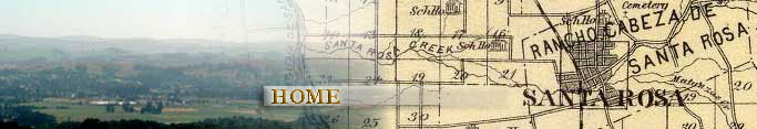
Figure 1: Map showing approximate location
of SCWA “Emergency Wells” near City of Sebastopol,
California.
After conducting 7 to 11 day pumping tests in 1978, SCWA
concluded:
“…use of the emergency wells does
have an impact on some of the nearby private wells and
some not so nearby… The most significant
effect occurred during pumping of the Occidental Road
well. Most of the monitored shallow wells within
a mile radius and varying in depth from 70 feet to 250
feet experienced a drop in water levels ranging from
1.0 to 13.0 feet.” (SCWA, 1978a)
In 1979, analysis of a pump test where all three “emergency
wells” were pumped simultaneously, SCWA concluded:
“Impacts on water levels of the local wells
followed the patterns experienced during earlier development
and pump tests” (SCWA, 1979).
Obviously, SCWA has known for over 25 years that pumping
from the “emergency wells” would impact neighboring
private wells.
After the 76-77 drought, the “emergency wells” were
not pumped much until 1998. The original Occidental Road
and Sebastopol Road emergency wells had water quality issues
(SCWA, 1979) and were re-drilled in 1998. Pumping
of the Todd Road emergency well resumed in 1998. Incidentally,
1997-1998 was the wettest year of the century for Santa
Rosa – hardly a drought-induced emergency! Regular
pumping of the Sebastopol Road and Occidental Road emergency
wells commenced in mid 2001 and mid 2003, respectively.
By late 2003, the three “emergency wells” were
pumping over 5 million gallons per day – more than
the City of Rohnert Park ever pumped. Figure 2 shows
pumping rates according to SCWA data beginning in mid 2001
and ending in late 2003.
In the 2004 Rohnert Park Draft Water Supply Assessment (WSA)
(Winzler & Kelly, 2004), water level data are presented
for SCWA wells, but these data are shown only through 1996.
Why? Perhaps because 1997 and later data would show downward
water level trends that would contradict key conclusions
of the WSA! SCWA has monitored water levels in monitoring
wells near the emergency wells since 1996. These data are
presented below.

Figure 1: Pumping rates for Occidental Rd, Sebastopol
Rd, and Todd Rd SCWA “Emergency Wells” from
mid 2001 to late 2003.
Groundwater Elevation Monitoring
Screened intervals for the emergency wells are:
Perforation
Interval |
Occidental
Rd. |
Sebastopol
Rd. |
Todd Rd. |
Top (ft
bgs) |
313 |
410 |
650 |
Bottom
of (ft bgs) |
773 |
1020 |
800 |
Several monitoring wells were installed adjacent to the “emergency
wells” at different depths:
Well I. D. |
Total
Depth |
Screened
Interval |
|
(ft bgs) |
(bgs) |
Occ MW 1 |
830 |
na |
Occ MW 2 |
90 |
60 - 80 |
Occ MW 3 |
92 |
67 - 87 |
Occ MW 4 |
830 |
na |
Occ MW 5 |
50 |
30 - 50 |
Santa Rosa |
40 |
20 - 40 |
Mattos |
~ 58 |
38 - 58 |
Seb MW 1 |
1030 |
na |
Seb MW 2 |
194 |
170 - 190 |
Seb MW 3 |
189 |
164 - 184 |
Seb MW 4 |
1035 |
na |
Seb MW 5 |
80 |
60 - 80 |
Seb MW 6 |
50 |
30 - 50 |
Seb MW 7 |
90 |
70 - 90 |
Todd Red |
80 |
na |
Todd White |
257 |
na |
Todd Blue |
570 |
na |
|
|
|
For both the Occidental Road and Sebastopol Road emergency
wells, “MW-1” and “MW-4” are screened
in deep zones similar in depth to the production zones
for the emergency wells. Occidental Road monitoring
wells “MW-2”, “MW-3”, and “MW-5” are
very shallow, screened at 60-80, 67-87, and 30-50 feet
below ground surface. Sebastopol Road monitoring wells “MW-2” and “MW-3” are
screened at 170-190 and 164-184 feet below ground surface
and, thus, are in the “shallow zone” (less
than 200 feet deep) according to the 2004 Rohnert Park
Draft Water Supply Assessment (WSA). Sebastopol Road monitoring
wells “MW-5” and “MW-7” are
very shallow at 60-80 and 70-90 feet below ground surface.
All references to depth zones are given for correspondence
to the Rohnert Park WSA depth-based method of categorizing
water level interpretation, which is not known to relate
to any hydrogeologic structure in the Santa Rosa plain.
The “shallow zone” is defined between 0 and
200 feet deep, the “intermediate zone” is defined
between 200 and 600 feet deep, and “deeper zones” are
below 600 feet deep.
The original Todd Road emergency well has three monitoring
wells: “Red”, “White”, and “Blue.” The “White” well
is 257 feet deep (shallow to intermediate?), the “Red” well
is 80 feet deep (very shallow), and the “Blue” well
is 570 feet deep (intermediate).
Through PRA requests by the Sebastopol Water Information
Group (SwiG) and the Open Space, Water Resource Protection,
and Land Use Foundation (O.W.L.),groundwater elevation
monitoring and well production data were obtained from
SCWA. SCWA used automated transducers to obtain water
level data between 2001-2004 at hourly intervals. The
data files span various time periods in various formats
and add up to hundreds of thousands of water level elevation
measurements. O.W.L. reduced the data into a common format
for plotting. Figure 9 of the WSA shows the location of
the Occidental Road and Sebastopol Road sites as wells “SCWA_06” and “SCWA_05” respectively
and the Todd Road site as “SCWA_01, SCWA_02, SCWA_03,
SCWA_04.”
Figure 3 shows 2001-2004 water level elevations for the Occidental Road emergency
well. Monitoring wells MW-1 and MW-4 are screened in the deeper zone production
interval. Water levels in MW-1 and MW-4 plunge to about sea level after
pumping begins in the Sebastopol Road emergency well in 2001 (see Figure 2).
The Sebastopol Road emergency well is located about 1.5 miles to the southeast
of the Occidental Road emergency well (see Figure 1). The impact of Sebastopol
Road emergency well pumping on Occidental Road site water levels indicates
emergency well pumping causes a broad cone of depression beneath the deep and
intermediate depths of the western Santa Rosa Plain groundwater subbasin. In
mid 2003, water levels plunge to about 40 to 80 feet below sea level. This
water level drop corresponds to commencement of pumping in the Occidental Road
emergency well (see Figure 2).
In Figure 3, the water levels in the Occidental Road monitoring wells MW-2
and MW-3 show decline since commencement of pumping at the Sebastopol Road
emergency well. Thus, the SCWA data show that pumping from a deep well can
affect very shallow zone water levels over 1.5 miles away. As pumping commences
at the Occidental Road emergency well in mid-2003, water level decline becomes
more severe in the very shallow zone. The water level in the very shallow well
MW-5 shows seasonal variation, suggesting local recharge.
Figure 4 shows 2001-2004 water level elevations for the Sebastopol Road emergency
well. Monitoring wells MW-1 and MW-4 indicate water level decline in the intermediate(?)
and deeper zone from +25 above sea level before pumping to between 40 and 100
feet below sea level after commencement of pumping in the Sebastopol Road emergency
well in mid 2001. A sharp water level decrease for Sebastopol Road
MW-1 in mid-2003 corresponds to commencement of pumping in the Occidental Road
emergency well (see Figure 2). Sebastopol Road monitoring wells MW-2 and MW-3
in the shallow zone show a corresponding water level decline with some seasonal
variation superposed on a long-term downward trend. Again, these data indicate
that deeper and intermediate zone pumping affects the “shallow zone.” Water
level records for the very shallow zone wells MW-5 and MW-7 are too short in
time duration to decipher long-term trends, but seasonal variations are evident. A
possible long-term downward trend could be interpreted for MW-5.
Figure 5 shows 1997-2004 water level depths for the Todd Road emergency well. Presentation
of data for the Todd Road emergency well are different here because (1) the
Todd Road emergency well has been pumping since 1998, (2) SCWA did not provide
a water level elevation information (only water level depth) and (3), the transducer
data begin in 2004. Year 2004 transducer data are tied to conventional water
level depth measurements since 1997.
The Todd Road emergency well has three monitoring wells: “Blue” (intermediate), “Red” (very
shallow), and “White” (intermediate to shallow?). The
water level depths in Figure 5 indicate that pumping from the Todd Road emergency
well induced water level decline in the intermediate zone of up to 100 feet in
1999 and 140 feet in late 2004. Thus, a long-term decline in the intermediate
zone water levels is evident in the Todd Road “Blue” monitoring well. Alternatively,
the downward water level change in 2001 could be attributed to commencement of
pumping from the Sebastopol Road emergency well. In that case, the three emergency
wells appear to produce an expansive cone of depression at least 4 miles long
in the deeper and intermediate zones beneath the Laguna de Santa Rosa in the
western Santa Rosa Plain groundwater basin between Sebastopol, Santa Rosa, and
Rohnert Park. The Todd Road “Red” monitoring well shows downward
water level trends in response to the Todd Road pumping. Thus, the Todd Road
well appears to impact very shallow zone water levels. The intermediate to shallow(?) “white” monitoring
well also shows a slight water level decline that mirrors the intermediate zone
water levels. The Todd Road monitoring well data collectively indicate that the “deep” Todd
Road emergency well pumping affects all depth intervals from deep to very shallow
zones.
Conclusions
A Public Records Act release of water level data for monitoring wells adjacent
to the SCWA “emergency wells” (which SCWA may now refer to as “groundwater
wells”; see SCWA, 2004) reveals continuing long-term water level declines
in the western Santa Rosa Plain groundwater subbasin. These water level declines
occur in shallow, intermediate, and deeper depth zones as defined by the 2004
Rohnert Park Draft Water Supply Assessment. The data show that water level
declines are laterally expansive in all depth-related zones. Water levels have
not shown full recovery in spring season in any zone except, possibly, the
very shallow zone (less than 100 feet deep). These water level data indicate
commencement of an overdraft condition corresponding with the commencement
of pumping by each of the Sonoma County Water Agency’s “emergency
wells” in 1998, 2001, and 2003. These data indicate overdraft conditions
exist in the Santa Rosa plain groundwater basin outside the City of Rohnert
Park’s city limits, contrary to the following claim of the 2004 Rohnert
Park Draft Water Supply Assessment (p. 2-14):
“…there is no corresponding indication of prolonged declining
groundwater elevations elsewhere in the subbasin in any zone, e.g., there is
no indication that overdraft has occurred at the subbasin scale.” (Winzler
and Kelly, 2004)
Notably, the “emergency wells” now contribute to Rohnert Park’s
water supply through Rohnert Park’s water supply contract with SCWA. Given
that SCWA has not announced any plans to cease pumping of the “emergency
wells,” a projected overdraft condition is expected to persist indefinitely
in the western Santa Rosa Plain subbasin. The recent upsurge in production
from the “emergency wells” indicates that a water shortage emergency
exists in Sonoma County . Why? According to SCWA:
“Water produced from the emergency wells …shall be available
for use only during a water shortage emergency…” (SCWA,
1977a)
References
SCWA 1977a, Memorandum from Gordon W. Miller, Chief Engineer,
to SCWA Board of Directors, August 1, 1977. Subject: Operation
of Emergency Wells.
SCWA 1977b, Memorandum from Gordon W. Miller, Chief Engineer,
to SCWA Board of Directors, September 12, 1977, Subject:
Agency and Rohnert Park emergency well drilling programs.
SCWA 1978a, Memorandum from Gordon W. Miller, Chief Engineer,
to SCWA Board of Directors, February 15, 1978, Subject:
Impacts observed on groundwater levels by pumping Agency’s
emergency wells.
SCWA 1979, Memorandum from John Kunselman to Richard W.
Norton, December 16, 1979, Subject: October 1979 pump test
of Agency’s three emergency wells.
SCWA 2004, “Water Supply Workshop”, Sonoma
County Water Agency Staff Report, November 1, 2004.
Winzler & Kelly 2004, Draft Water Supply Assessment,
City of Rohnert Park , October 2004.

Figure 3: Water level elevations in SCWA’s
Occidental Road emergency well monitoring wells.

Figure 4: Water level elevations in SCWA’s
Sebastopol Road emergency well monitoring wells.

Figure 5: Water level elevations in SCWA’s
Todd Road emergency well monitoring wells.