The Jury Is In!
Judge Davis delivers the verdict
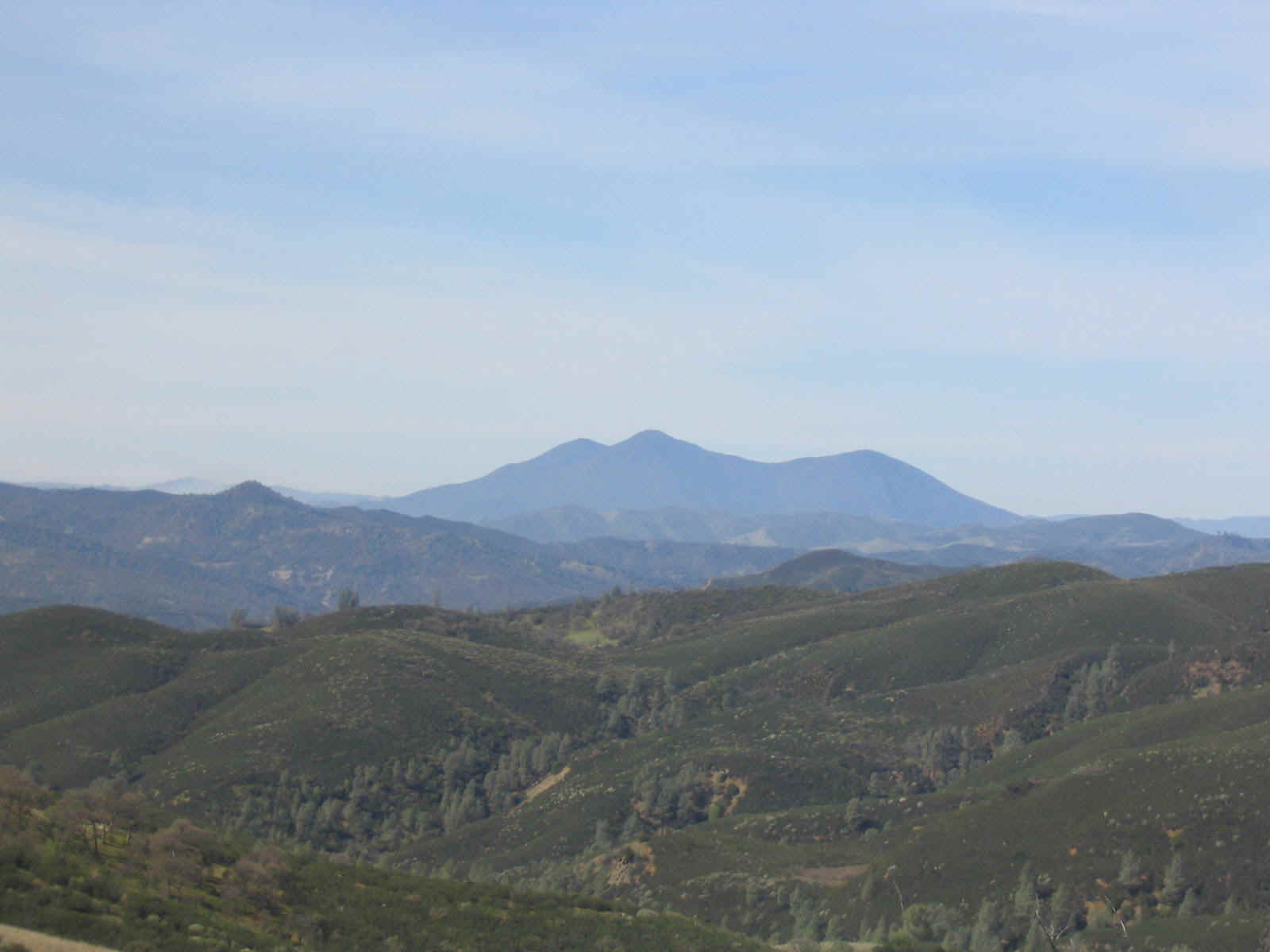
Mt. Konocti stands majestically in the distance
Sunday, March 14 ushered in a delightful day. The sky was completely clear and the temperature was in the low sixties as Jim and Eric headed back to the Cache Creek Wilderness area to explore the possibility of riding the monstrous Judge Davis trail to Wilson Valley and then onto the Redbud Trail, returning to the North Fork parking lot. We had ridden the trail in the other direction, the uphill way. It was epic and involved most of the day, all of the calories available and all of the water we had. The notion of having five miles of raging downhill held great appeal.
The only factor that wasn’t considered much was the required water crossing. On the previous mission we had been barely able to ford the swift moving Cache Creek. We knew the river would likely be as high, if not higher since this sortie was earlier in the springtime than last year’s ride. The concept of ropes was considered, a little too late though as we drove towards the drive. Jim had about fifteen feet of poly rope, seemingly not enough to reach across the river.
This ride was done with a car shuffle. On the previous ride we had ridden the nine miles on the highway back to the North Fork parking lot. That effort put the ride into the category of “Are we there yet?” Starting at noon, We started the tough climb to the top of the terrain. It was a good warm up for the day. The fortunate part of the climb was that it didn’t last very long. It was perhaps a mile and less than 500 vertical feet. The terrain to the southeast opened majestically as the trail passed over the high terrain. Spectacular views of Mt. Konocti, Snow Mt., Cobb and Boggs mountain feasted the eye. There was only slight confusion about the direction of the trail. The proper route soon became very obvious. The trail was seen far down the descending terrain, dropping into the deep creases of the Cache Creek Wilderness Area.
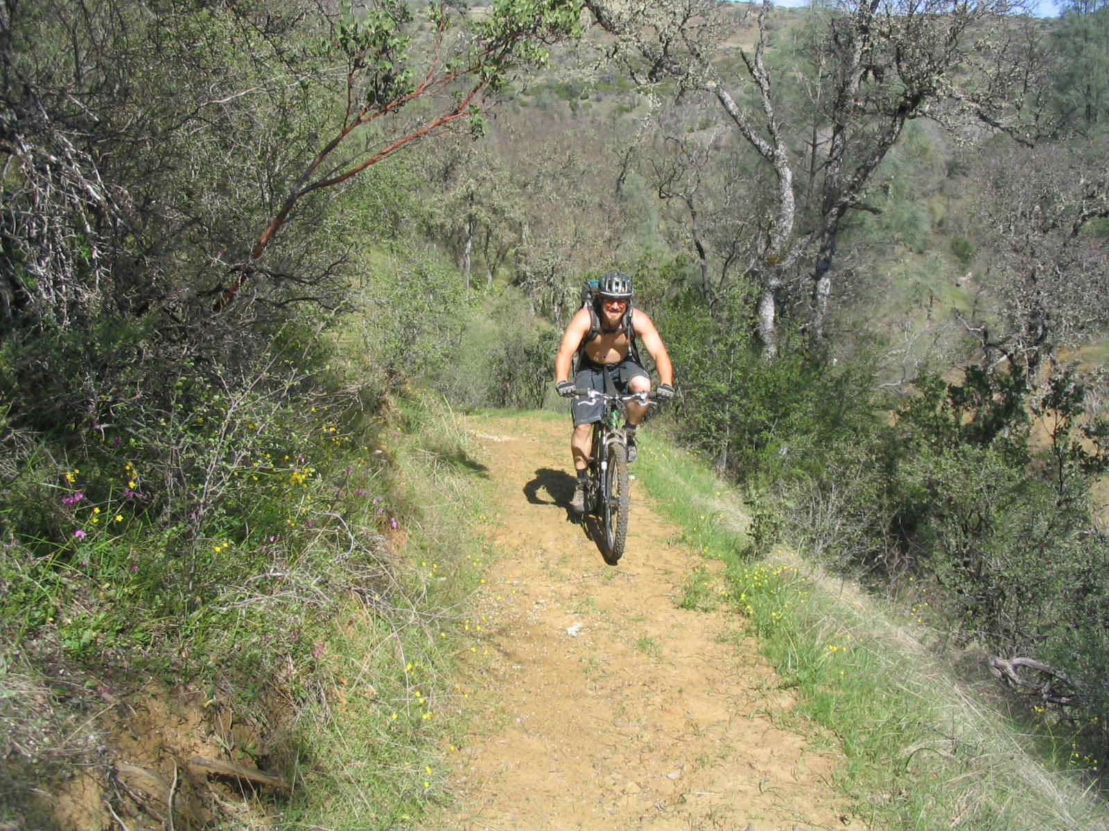
Jim heads up the first climb
What had taken hours to climb took only minutes to descend. The trail was mostly smooth although horses had trashed areas of the trail during recent wet periods. The route drops nearly two thousand vertical feet in a series of steep hills. There are several short uphill sections that can be processed quickly especially if one keeps great velocity approaching them. There are water bars all the way down. Several sections of water bars are smooth on both sides creating ideal flight time for the enthusiastic rider. Oak trees appear towards the bottom of the trail. The trail narrows briefly to a single track. It switches back several times then dumps out onto the river valley floor.
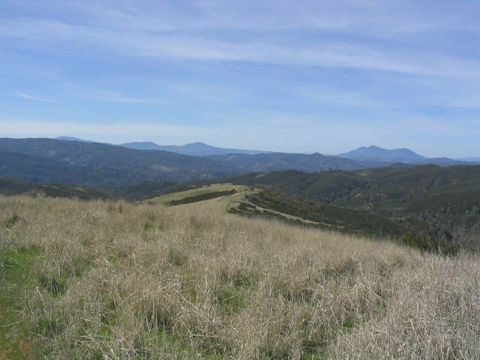
Looking down into the Cache Creek Wilderness Area
The question of the day was; how much water was in the river? There were visions of torrents of water preventing a safe crossing. To make the climb back up the hill would have been horrific. All sorts of plans had been discussed. It was thought that one person could swim across, then by rope the equipment could be passed to the other shore. Jim selected the spot he thought looked the best and tested the water. After wading only a few feet from shore, the swift moving water was nearly to his waist. With a bike and backpack it would have been sketchy at very best and likely would have ended in a statistics column. The two continued to search along the shore for a better option. In that process Eric noticed several large logs.
“Hey Jim,” Eric said. “Let’s build a raft.”
It was a plan. Eric got his folding saw out and began to cut through the six inch logs. Within a half hour we had fashioned a crude but workable raft. We loaded the bikes and packs on the Tom Sawyer rig and dragged it to the edge of the river. The water was only about 18 inches deep at the edge of the current. We managed to get the raft into the water and began to push across the current. Expecting the water to get deep, we cautiously proceeded. The water was turbid and it was impossible to see the bottom. If we could have, we would have seen that it was only 18 inches deep all the way across this particular section.
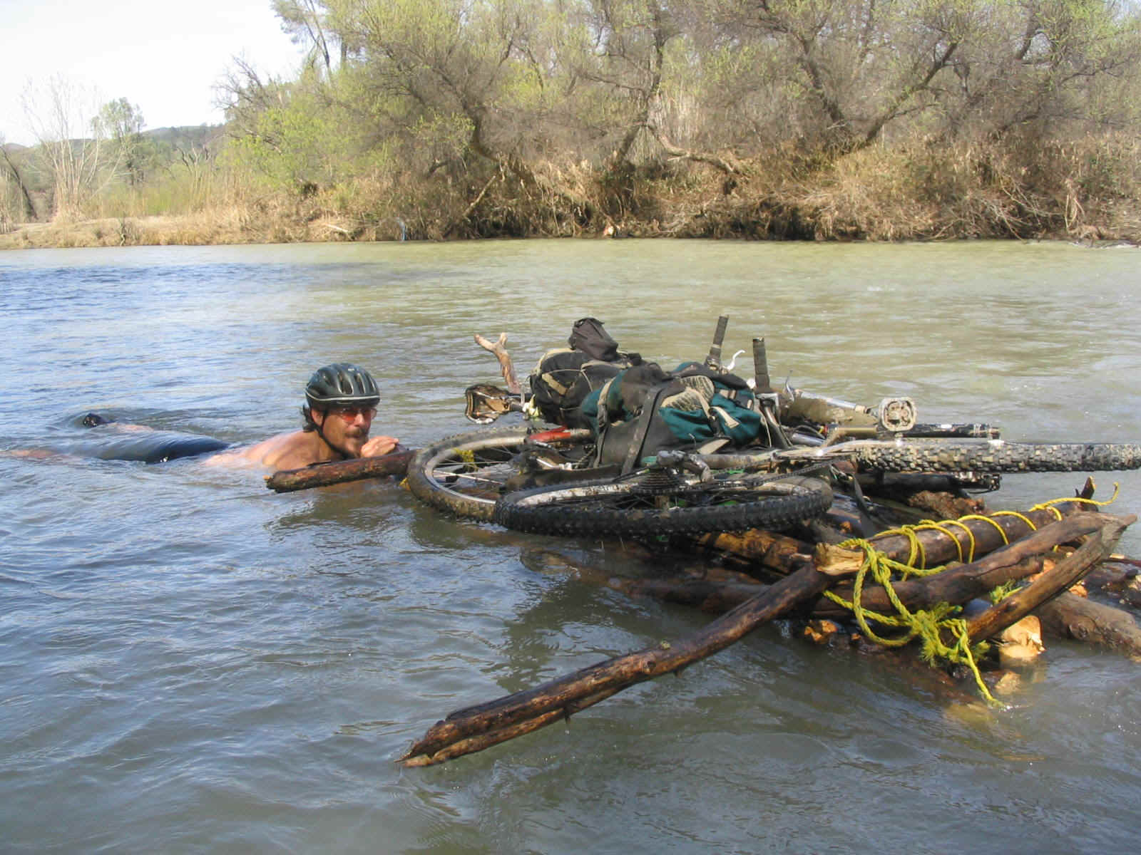
Tom Sawyer would have been proud
We were delighted to be on the other side. Now all of the (needless) concerns about the river were over. It was time for an extended break in the afternoon sun. The day was delightful. The temperature was in the mid seventies. The springtime was beginning to offer an array of new and growing plants. The wild flowers were just getting started. The Wilson Valley was lush and green. The meadows appeared as if out of a tropical garden. Birds chattered in the trees and a Bald Eagle soared overhead. We ate some munchies and Eric dried his shoes, in part by centrifuging them on the end of an eight foot cord.
The ride across Wilson Valley was smooth and level. At the northeast end of the valley the terrain begins to climb towards a plateau that overlooks a narrow part of Cache Creek. The climb was steep in parts but didn’t last as long as we had anticipated. Soon we were on the plateau and pedaling towards the next part of the journey. On our first sortie we had only managed to get as far as the section prior to the plateau. There was one intersection that could have caused confusion, but it was taped and Jim accurately remembered the route. A descent put us into the next valley near the river. It was very narrow and wooded. We encountered the second of three river crossings. This one was almost dry and it was easy to use rocks to step across the water.
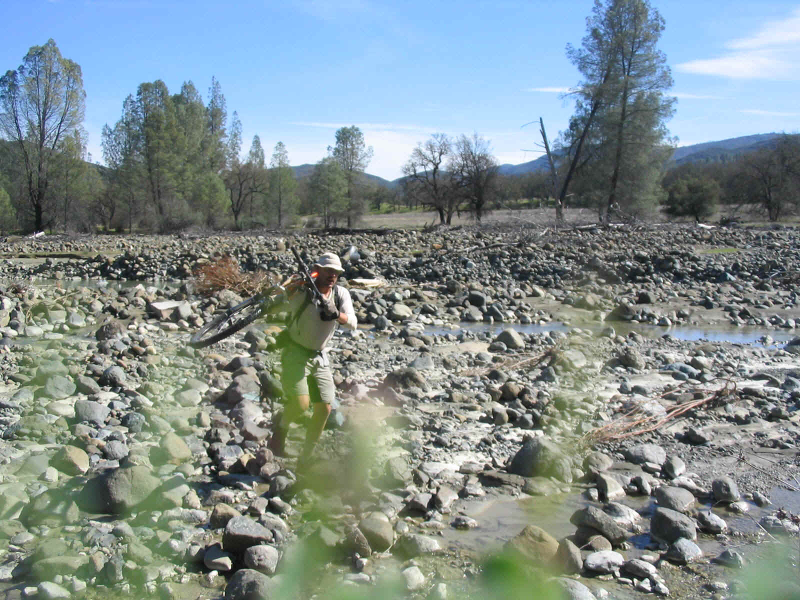
Eric rock-hops across the creek
A huge landslide had changed the landscape and the trail had been Altered to climb over the affected area. Then it descended again. It travel briefly across a small, yellow flowered meadow and arrived at the other Cache Creek river crossing. We weren’t worried about this one. It was upstream from the North Fork confluence and didn’t have very much water. It would require getting the feet wet, but Jim wisely had brought river shoes and Eric opted for the shoe slinging routine and his pair of dry socks. Another break was in order to simply soak up the beauty of the day. We hadn’t seen any other people other than a raft earlier, from high on the Judge Davis Trail. The singing stream helped to soothe the spirit and infuse a sense of gratitude for having access to such a nice place on this beautiful spring day.
The Redbud Trail climbs vigorously from the river to a ridge high above the two forks of Cache Creek. Near the top of the trail we took a moment to pause at a spur that juts out. The short trail to the lookout was Jim’s undoing as he managed to stack on the last turn. Only temporary damage occurred. For several minutes he was wincing, talking with great difficulty and holding his crotch. The rest of the trail to the parking lot is as nice as it gets. The surface is smooth. The trail is lined with flowers as it undulates, twists and winds down the hill.
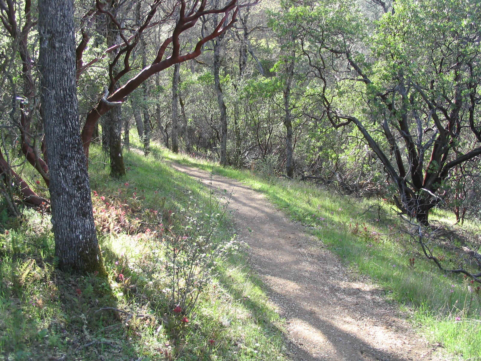
The Redbud Trail invites fat tires
Again Jim experienced an interesting, but not desirable situation. As he slid to a stop at one sharp corner, he was approached by a fast moving, aggressive and mean looking Rotweiler. Fortunately the owner was nearby and commanded the charging dog to stop. Another surge of adrenaline assisted Jim in making good time to the parking lot.
The car shuffle ended the day of superb riding. It was a route that offered great challenge and adventure. It offered a delightful surprise with the water crossing and gave the two many scenes of grandeur that will last for a long time in the memories of these bikin’ fools.