To illustrate how much typical paths and terrain can degrade the potential of a higher speed digital radio network, here is a practical example from our local 230 kbps amateur radio TCP/IP network.
The distance from redwood3 to santarosa is only about 3 miles. It is over very flat terrain through a combination of residential and commercial areas. It has only an average amount of trees. However, at 904 MHz, even with antennas at 30-60 feet AGL, this path has ~50 dB of incremental path loss above that of the same length path in a free space environment. In addition to the problem of extra loss, there is also a large amount of distortion due to the presence of significant multipath components. This situation makes the path unusable with the simple FSK 230 kbps digital radios.
To combat this situation, the redwood gateway is being used to provide connectivity between santarosa and redwood3. To appreciate how breaking a bad ~3 mile path into two good ~25 mile paths can help matters first look at the below image which shows the terrain. The camera is looking approximately west.
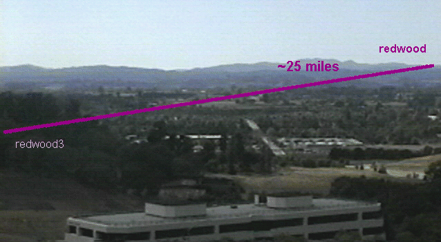
Picture of the terrain between redwood3 (in Santa Rosa, Calif) and redwood
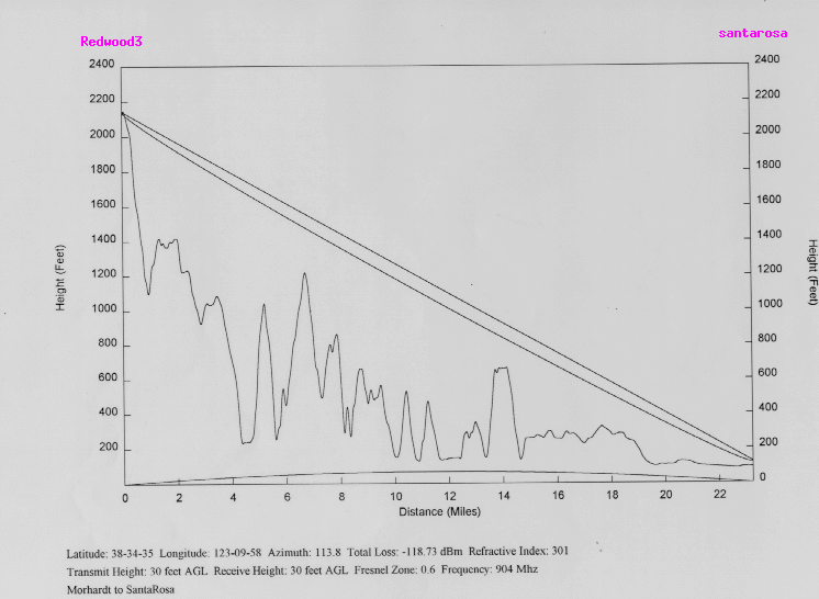
The elevation profile for the path from redwood to to the santarosa valley floor shows why, for RF purposes, it is a good one. Note that the vertical and horizontal distance scales are quite different. The curved line shows the .6 Fresnel zone for path and frequency.