|
click
here
to see new Clark County page, otherwise, check out Sonoma
County, CA below
|
Current
temperature in downtown Santa Rosa is
 |
|
|
|
|
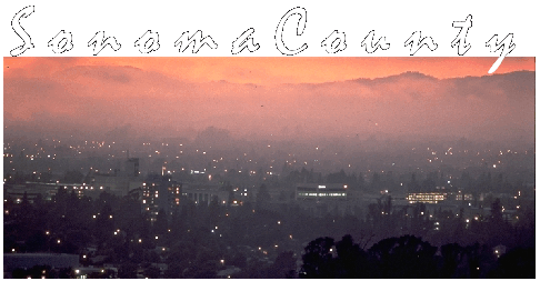 Sonoma
County is one of the world's most beautiful places, offering
a wide and diverse range of scenery from semi-tropical
redwood rainforest to rolling grassy hills to dense hardwood
forests of Oak and Madrone to swampy bay marshland, and
rugged high country in the Mayacamas Mountains. Map click
here. Sonoma
County is one of the world's most beautiful places, offering
a wide and diverse range of scenery from semi-tropical
redwood rainforest to rolling grassy hills to dense hardwood
forests of Oak and Madrone to swampy bay marshland, and
rugged high country in the Mayacamas Mountains. Map click
here.
The county is also one of the world's most diverse
agricultural areas offering literally scores of different
crops and ag products including wine, dairy, fish, apples,
vegetables and livestock. Virtually every kind of ag product
is produced in Sonoma County's $3 billion ag industry!
Sonoma County's ag products are always among the highest
quality in the world. I challenge anyone to find more scenic
and agricultural diversity in 1579 square miles anywhere on
earth!
Sonoma County is also home of great recreational opportunity
from rugged and undeveloped wilderness to posh city parks.
Mountain Biking, Hiking and Horseback riding are very
popular on hundreds of miles of trails. Lake Sonoma offers
all forms of lakeside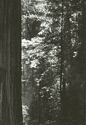 recreation and watercraft activities.
The Sonoma Coast is truly an unspoiled and magnificent
wonder. The Russian River offers the full range of
recreation including some of California's finest stands of
ancient redwoods. Sonoma County is filled with charming
little towns like Sebastopol, Healdsburg, Sonoma,
Guerneville and Bodega Bay, just a few of the dozens there
are. Sonoma County is also home to Santa Rosa a city that
has come of age and grown into a well kept small
metropolitan city that Forbes magazine named one of the
"most dynamic places" in the nation. The kids can
go crazy at Howarth Park, Scandia, Windosr Waterslides and
more. Do you like the nightlife? There are dozens of
clubs with nearly every kind of live music imaginable. The
county boasts every kind of entertainment for everyone from
infants to grandparents with no-one excluded! recreation and watercraft activities.
The Sonoma Coast is truly an unspoiled and magnificent
wonder. The Russian River offers the full range of
recreation including some of California's finest stands of
ancient redwoods. Sonoma County is filled with charming
little towns like Sebastopol, Healdsburg, Sonoma,
Guerneville and Bodega Bay, just a few of the dozens there
are. Sonoma County is also home to Santa Rosa a city that
has come of age and grown into a well kept small
metropolitan city that Forbes magazine named one of the
"most dynamic places" in the nation. The kids can
go crazy at Howarth Park, Scandia, Windosr Waterslides and
more. Do you like the nightlife? There are dozens of
clubs with nearly every kind of live music imaginable. The
county boasts every kind of entertainment for everyone from
infants to grandparents with no-one excluded!
Do you like golf? There are more than 300 holes on some 21
courses in the county including, Bodega Golf Links on the
Oceanfront is second only to Pebble Beach! Fountaingrove is
a challenging and steep hilly course and Northwood is a
beautiful nine holer literally in a redwood forest! Just to
name a few. Check out the courses at golfable.com.
Auto racing fan? Petaluma has a 3/8 mile dirt oval with
weekly racing from April to October of Sprint cars, late
models and more. Of Course there is Sears Point
International Raceway, home of NASCAR, NHRA drag racing,
IMSA and many more. Sonoma County has 3 fairgrounds
facilities and numerous other events facilities. Every
weekend there are numerous major events going on, no-one is
left out.
Do you like eating out! The county has well over 1000
restaurants from fast food to fine dining. There are dozens
of absolutely top notch places to dress up and dine out. And
if you want something less "formal" then
there are scores of quaint and charming cafes/bistros that
offer a variety of fine cuisine from every place on earth
and most of the finer restaurants use Sonoma County products
including, Dairy and Cheese, Veal, Lamb, Chicken, Turkey,
Beef, Quail, Duck, Salmon, Trout, Bass, Halibut, Crab,
Oysters, tomatoes and assorted greens, apples and assorted
fruits and of course Sonoma County wines (wines from
those other places are usually available also.)
History? Oh yes, Petaluma and Sonoma are well over 150 years
old and both were spared devastation in major quakes over
the decades. There is Fort Ross which is knocking at the
door of 200 years (1812). Petaluma has one of the West
Coast's most extensive collections of Iron front buildings
and classic restored Victorian homes.
Of course we can't forget about the wineries, over 170 of
them pumping some $3 billion into the local economy! Sonoma
County has more acreage planted in premium wine grapes than
any other county in the country including our famous
neighbor, Napa. Sonoma County's wide ranging terrain
provides a climate and soil for virtually all varieties of
wine grapes. The county has several wine regions including
the Russian River Valley, Dry Creek Valley, Alexander
Valley, Sonoma Valley, The Valley Of The Moon and Carneros
(shared with Napa). If you are coming to The Wine Country,
consider this, Sonoma County offers far more non-wine
activities then neighboring Napa (wine is all they have
over there.) and from Santa Rosa, the most beautiful
part of Napa Valley (Calistoga to Rutherford) is only
12 miles away, closer actually than the city of Napa itself!
You can do Napa Valley in a day or weekend, but Sonoma
County is an endless ride of great activities, come for a
day, come for a month you won't get bored! Lodging ranges
from charming Bed and Breakfast inns all over the county, to
The Hilton, Doubletree, and other premium hotels, The
ultra posh Sonoma Mission Inn, or even the good ole' cheap
motel!
|
|
 |
Click
on the map to see information on that area.
|
|
History
:
Originally
settled by Miwok, Pomo, and Other Coastal Indians for
thousands of years,
Visited
by Sir Francis Drake in 1579 (Drake officially landed 20
miles south in Marin County but mapped the whole
Marin/Sonoma coast
Settled
by the Russians in 1812(fur trapping)
Settled
by the Mexicans in 1821 (Mission Sonoma)
Settled
by American Pioneers in 1828 at Cotati, 1834 at Petaluma
The
Flags of 7 nations have flown over Sonoma County,
|
|
|
England 1579
Spain 1602-1775
-
Russia 1804-1842
-
Mexican Empire 1821-1823
Mexico 1823-1846
The Bear Flag Republic 1846
U.S.A. 1850-Date
|
|
Geography
:
53 miles of
Pacific Ocean coastline, 12 miles of San Francisco bay
shoreline.
3
rivers, the Petaluma, the Russian and the Gualala. 3
recreational lakes, Lake Sonoma, Spring Lake and Lake
Ralphine.
Lowest
point, sea level.
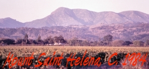
- Highest Point Mt. St. Helena North Peak,
4344 ft.
|
|
Economy
Sonoma County enjoys
one of the most diverse economies in the world. In
addition to the aforementioned $3 billion agriculture
industry there is a nearly $1 billion tourist industry,
multi-billion dollar electronics and communications
industries. The county is a major shopping destination for a
regional area covering the entire North Coast of
California. Major manufacturing and distribution have
long been a part of the local economy.
Here in Sonoma County
there is old money and new money. The economy is so
diverse that even during tough recessions in the early
eighties and early nineties, we were well sheltered.
Unemployment is always well below the national average and
as of 10/2000 it sat at a mere 2.3%. Unlike some areas
such as Marin County to our South, Sonoma County is not just
a rich enclave to a larger city. Sonoma County
is almost completely independent of it's much larger
metropolitan neighbor, the San Francisco Bay Area.
Although Sonoma County is part of the US Census Bay Area
Megalopolis data in 2005 showed that less than 6% of Santa
Rosa residents commuted to work outside of Sonoma County!
There is a wide
variety of social and economic diversity from struggling
families to the billionaires. The median home price as
of 9/2003 is $428,000, well below the Bay Area median of
$550,000 but homes are available in some neighborhoods for
under $325,000 and in others they are over $5,000,000.
The recent downturn in real estate has
brought the median home price in early 2009 into the more
affordable $300,000 range.
Typical
climate
 Microclimates galore, coastal areas like Bodega Bay often
are fogged in all day in the summer and almost always at
night and the temperatures are warm in the winter and cool
in the summer. Petaluma and Rohnert Park get allot of
coastal influence and the climate there is reflective.
Further north the valleys are surrounded by towering
mountains that block the coastal flow and provide shelter
for cooler temps in the winter and hot temps in the summer.
Winters may seem strange here especially in the sheltered
valleys, Temps may drop into the 20's on a clear night
and them warm to 60 degrees by noon, by the same token
sheltered canyon areas like Pocket Canyon and Ice Box Canyon
never see the sun in January and temps are stuck in the 40s in
the day and in the low 20s at night! This area
enjoys a seemingly endless Indian summer that extends deep
into October and days at the coast are relatively fog free
during the autumn. The true joy of Sonoma county weather is
that when it gets real hot, say 100 degrees the humidity
always drops to a bone dry say 25% and then it rises up to
70% when the temperature drops back down and the fog rolls
in. Never a 90/90 day here 90 degrees 90%, thank God!
Snowfall in winter is common on higher peaks, rare in the
valleys, almost never on the coast.
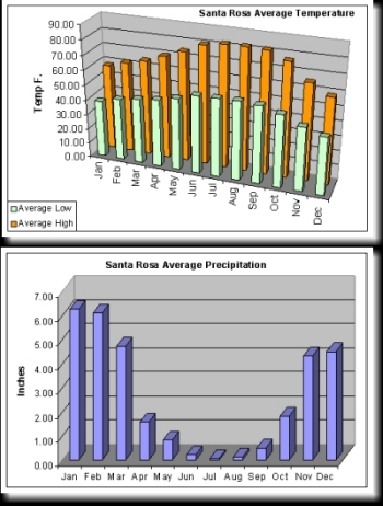
Rainfall ranges from a drenching 72 annual inches in
Cazadero to 25 inches in drier valleys. Rain begins to
fall in November and typically continues at a feverish pace
until March but it almost never rains between Memorial Day
and Labor Day. Sonoma County has 2 seasons, Wet and
Dry. Dry lasts about 5 months and wet lasts about 7.
|
|
Cities
and Places :
- Santa
Rosa. Seat of County Government.
Settled in 1836 incorporated in 1868. 2000
population, 153,000 city proper, 200,000 including several
un-incorporated adjacent communities. Largest city
from the Golden Gate to Portland Oregon. Covers more
than 50 square miles ranging in elevation from 90-1100
feet. Served by Horizon / Alaska Airlines
at the Sonoma County Airport, with daily non-stops to the
Bay Area and Los Angeles and now featuring non-stops to
Portland and Seattle. 54 miles N.W. of San Francisco.
The only city in the North Bay Area that imports workers
(more jobs than workers) Annual precipitation 30 inches rain, snow is very rare
except at higher elevations. July temperature
averages 52L to 83H over 100 degrees 5-10 times a year.
January temperature averages 38L to 58H perhaps 20
sub-freezing days a year and rarely a "hard
freeze" less than 26 degrees. Back
to map.
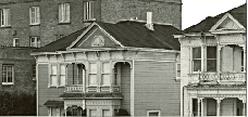 Petaluma,
settled in 1834, incorporated in 1858. 2000
population, 55,000. Heart of the county's dairy
industry with a rich and golden history. In the late
1800s the city was one of the state's largest and most
prosperous. Active river-port. Covers 16
square miles ranging from sea level to 600 feet. 38
miles N.W. of San Francisco. Climate similar to
Santa Rosa but with more coastal fog and low clouds in the
summer. Back to map. Petaluma,
settled in 1834, incorporated in 1858. 2000
population, 55,000. Heart of the county's dairy
industry with a rich and golden history. In the late
1800s the city was one of the state's largest and most
prosperous. Active river-port. Covers 16
square miles ranging from sea level to 600 feet. 38
miles N.W. of San Francisco. Climate similar to
Santa Rosa but with more coastal fog and low clouds in the
summer. Back to map.
Rohnert
Park, virtually non-existent prior to 1955.
One of America's very first "planned
communities". Incorporated in 1962. 2000
population, 40,000. Covers 7 square miles at
elevation 110 feet. 48 miles N.W. of San Francisco.
Climate similar to Petaluma. Home to Sonoma State
University. Back to map.
Windsor,
settled in the 1850s but incorporated in 1992 this is the
county's newest city. 2000 population, 23,000.
Covers 7 square miles elevation 100-300 feet. 64
miles N.W. of San Francisco. Climate similar to
Santa Rosa. Surrounded by vineyards and mountains.
Back to map.
Healdsburg,
incorporated in 1857. 2000 population, 10,500.
Healdsburg is a charming wine country town with grand
historical character and lots of tourism. Covers 4
square miles elevation 130-800 feet. 70 miles N.W.
of San Francisco. Climate warmer in the summer and
colder in the winter than Santa Rosa. Perhaps 40
sub-freezing days and 15-20 100 degree days per year.
Russian River resorts. Back to
map.
Sonoma,
settled in 1819 by the Spanish, Mission San Francisco de
Solano built in 1821. Easily the oldest "city"
in the county. Incorporated with statehood in 1850. 2000
population, 9,600 city proper, Sonoma Valley area 27,000.
Covers 2 square miles at elevation 90 feet. 42 miles
North of San Francisco. This city is gorgeous,
surrounded by beautiful mountains and vineyards.
Climate in the Sonoma Valley varies from Petaluma-like to
Healdsburg-like. Back to map.
Sebastopol,
settled perhaps as early as 1812 as it was named by the
Russians from Fort Ross. Incorporated in 1900.
2000 population, 7,900 ; greater Sebastopol area 20,000.
Covers 2 square miles from elevation 70-600 feet. 56
miles N.W. of San Francisco. Sebastopol is the hub
of the West County area. It is the home of the region's
Gravenstein Apple growing area. It has grown into a
affluent community with residents lured by the rolling
hills, redwood forests and spectacular views.
Climate in the summer is similar to Santa Rosa but winter
nights are chillier with sub-freezing clear nights more common. Back to map.
Cotati,
settled in 1828, incorporated in 1963. 2000
population 6,800. Covers 2 square miles elevation
100-300 feet. 47 miles N.W. of San Francisco.
Cotati is an interesting mix of old and new urban design
and is truly centrally located at the junction of highways
116 and 101. Back to map.
Cloverdale,
incorporated in 1920. 2000 population, 7,100.
Covers 2 square miles at elevation 300-500 feet.
Cloverdale is, northernmost, hottest and perhaps coldest
city in Sonoma County. At the top of the prestigious
Alexander Valley wine growing region Cloverdale is a town
all it's own. It has it's own annual fair, The
Citrus Fair. Cloverdale's climate is very warm in
the summer with July averages 55L to 93H and routinely
sees 100 plus degree days. Fortunately the humidity
remains low on hot days. In the winter the mercury
drops below freezing on almost any clear night.
January averages 38L to 56H. Cloverdale is tightly
surrounded by a rugged canyon formed by the Russian River.
Towering mountains in nearly every direction. Back
to map.
Cazadero,
1998 population, 900. Elevation at the town is 200
feet but terrain varies up to Pole Mountain at 2200 feet.
90 miles N.W. of San Francisco. This is the wettest
spot in the county. A staggering 72 inches of annual
precipitation. 100 inches is common in wetter years.
Many residents live deep in the "back-woods"
an hour away from the charming town. Back
to map.
Bodega
Bay, 1998 population, 2,000. 58 miles N.W.
of San Francisco. An active fishing and recreational
seaport. The counties most moderate climate.
January averages 43L to 58H with only rare sub-freezing
temps. July averages 50L to 68H. Temps over 80 are
uncommon. Some of the most spectacular coastline
scenery in the world resides just north of Bodega Bay.
Back to map.
Guerneville,
the heart of the Russian River Resort Area. 75 miles
N.W. of San Francisco. This area contains over
15,000 residents and doubles it's population in the
summer. There are a dozen communities along the "lower
Russian River" from Forestville to Monte Rio.
Elevation ranges from 40 feet at the river's edge to over
500 feet up the steep canyon slopes. This area is
heavily forested in evergreens including the fabulous
Redwoods. Back to map.
Fort
Ross, settled in 1812 by the Russians and
abandoned shortly thereafter. The Fort remains as a
State Historical Park. Back to
map.
The
Geysers, once the largest Geo-thermal power plant
in the world this area is volcanically active. The
bottom of Sulfur Canyon sits at an elevation 2000 feet.
Geyser Peak and Black Mountain rise up well over 3000 feet
to the west (Geyser Peak 3420 feet) and to
the east the Mighty Cobb Mountain climbs to 4720 feet (the
Lake County line resides at roughly the 4500 foot level.)
This creates an dark canyon in the winter that
provides the county's only real winter weather. Snow
is common in the winter and temps routinely dip into the
teens on clear nights.
January averages from 31L to 45H. Back
to map.
The
Great Northwest, this is truly an unspoiled area.
Hundreds of square miles of rugged terrain ranging from
semi-arid mountains to semi-tropical rain forest.
The only town per-say is the ultra-remote Annapolis.
This is a town for those who choose to live as far away
from modern civilization as seemingly possible.
Annapolis is 2 hours drive from Santa Rosa and many
residents live another 90 minutes from the town. Back
to map.
Sea
Ranch, 120 miles N.W. of San Francisco, this area
is a retirement community of mostly affluent homes right
on the Pacific Ocean. When you choose to live here
you are very far away from any urban center. Santa
Rosa is nearly 60 miles away on a slow winding highway,
but when you live here you live in one of the most
spectacular scenic areas in the world! Back
to map.
|
|
Major
Parks :
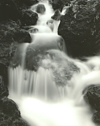
Annadell State Park, 5000 acres
Austin Creek State Recreation Area, 5000+ acres
Armstrong Redwoods State Park
Fort Ross State Historic Park
Hood Mountain Park
Howarth Memorial Park
Jack London State Park
Lake Sonoma Recreation Area, 18000 acres
Salt Point State Park, 5500+ acres
Sonoma State Historic Park
Sonoma Coast State Beaches, 15 miles of em!
Sugarloaf Ridge State Park
Vallejo's Petaluma Adobe State Historic Park
Back to map.
|
|

|

![]()
 Sonoma
County is one of the world's most beautiful places, offering
a wide and diverse range of scenery from semi-tropical
redwood rainforest to rolling grassy hills to dense hardwood
forests of Oak and Madrone to swampy bay marshland, and
rugged high country in the Mayacamas Mountains. Map
  recreation and watercraft activities.
The Sonoma Coast is truly an unspoiled and magnificent
wonder. The Russian River offers the full range of
recreation including some of California's finest stands of
ancient redwoods. Sonoma County is filled with charming
little towns like Sebastopol, Healdsburg, Sonoma,
Guerneville and Bodega Bay, just a few of the dozens there
are. Sonoma County is also home to Santa Rosa a city that
has come of age and grown into a well kept small
metropolitan city that Forbes magazine named one of the
"most dynamic places" in the nation. The kids can
go crazy at Howarth Park, Scandia, Windosr Waterslides and
more. Do you like the nightlife? There are dozens of
clubs with nearly every kind of live music imaginable. The
county boasts every kind of entertainment for everyone from
infants to grandparents with no-one excluded!

 Microclimates galore, coastal areas like Bodega Bay often
are fogged in all day in the summer and almost always at
night and the temperatures are warm in the winter and cool
in the summer. Petaluma and Rohnert Park get allot of
coastal influence and the climate there is reflective.
Further north the valleys are surrounded by towering
mountains that block the coastal flow and provide shelter
for cooler temps in the winter and hot temps in the summer.
Winters may seem strange here especially in the sheltered
valleys, Temps may drop into the 20's on a clear night
and them warm to 60 degrees by noon, by the same token
sheltered canyon areas like Pocket Canyon and Ice Box Canyon
never see the sun in January and temps are stuck in the 40s in
the day and in the low 20s at night! This area
enjoys a seemingly endless Indian summer that extends deep
into October and days at the coast are relatively fog free
during the autumn. The true joy of Sonoma county weather is
that when it gets real hot, say 100 degrees the humidity
always drops to a bone dry say 25% and then it rises up to
70% when the temperature drops back down and the fog rolls
in. Never a 90/90 day here 90 degrees 90%, thank God!
Snowfall in winter is common on higher peaks, rare in the
valleys, almost never on the coast.
 Petaluma,
settled in 1834, incorporated in 1858. 2000
population, 55,000. Heart of the county's dairy
industry with a rich and golden history. In the late
1800s the city was one of the state's largest and most
prosperous. Active river-port. Covers 16
square miles ranging from sea level to 600 feet. 38
miles N.W. of San Francisco. Climate similar to
Santa Rosa but with more coastal fog and low clouds in the
summer.
